|
©The Archaeological Settlements of Turkey - TAY Project
|
|
|
|
|
|
Merdivenli Magara |
|
|
For site maps and drawings please click on the picture... 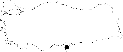 |
For photographs please click on the photo... 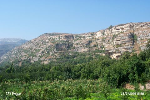 |
|
Type:
|
Cave |
|
Altitude:
|
60 m |
|
Region:
|
Mediterranean |
|
Province:
|
Hatay |
|
District:
|
Samandag |
|
Village:
|
Magaracik |
|
Investigation Method:
|
Excavation |
|
Period:
|
OP ÜP |
|
|
|
  |
|
| Location: This cave site is located southwest of the city of Antakya; in the caves immediately southwest of the village of Magaracik; 4-5 km northwest of the town of Samandag. This cave does not have a local name. Senyürek and Bostanci; who discovered the site; at first called it "Cave 1" and later began referring to it as "Merdivenli Magara" which literally means "cave with steps". |
| Geography and Environment: The cave; which today is 36-39 m above sea-level; is approximately 23 m deep. 6 m wide and 2.1 m high. The entrance of the cave faces south. This cave and the other caves located on the southern flanks of Mount Musa Dag were formed in Miocene limestone. The cave ceiling as well as the eastern and western walls are covered with gritty sandstone which includes land-snail shells; fossilized mammal bones and teeth. The researchers believe that this is because the whole cave including the ceiling was submerged under the sea at one point. The west wall of the cave was quarried by the inhabitants of the city of Selevkia. At this time a staircase; which explains the name of the cave; was also carved outside the entrance |
| History: |
| Research and Excavation: After the cave's discovery in 1956 three seasons of excavation were conducted in 1956 and 1957. Six test trenches were excavated under the direction of Muzaffer Senyürek and Enver Bostanci. The researchers report that a total of five layers were exposed: Layer I is Roman; Layer II and III are Upper Palaeolithic; Layer IV and V are Middle Palaeolithic. The first layer; which is between 25-35 cm in thickness; is reported to be composed of black organic soil. The second layer is light brown in color and 118 cm thick. The third layer; also composed of black soil; is at most 50 cm thick. The forth layer; which is dark brown in color; is 47 cm thick. The fifth layer; which is yellow and lighter in color; is about 190 cm thick. Beneath this layer are several thin striated strata. It is suggested that these strata consist of sea-born deposits. Bedrock was not reached in the 571 cm excavated. During the survey performed by E. Güleç et al. in 2008 for the identification of material sources of stone tools, 10-30 cm silex bulbs were found inside the carbonate sediments on the terraces southeast of Sebenoba Village on the road to Yayladagi. These were frequently used in the Merdivenli and Tiklali Caves in Çevlik, in Üçagizli II Cave and the antecedent Palaeolithic levels of Üçagizli Cave [Güleç et al. 2010: 366]. |
| Stratigraphy: |
| Small Finds: The first layer; which dates to the Roman period when the area was settled by the inhabitants of the city of Selevkia; yielded some oil lamps and some fragments of pottery. The second and third layers yielded points; blades; end scrapers; nosed scrapers; flake scrapers; steep faced scrapers and borers characteristically Middle Aurignacien and assigned to the Upper Palaeolithic. These layers also yielded some bone tools including a hatchet; an awl; the bottom portion of a needle. Between Layer III and Layer IV is a thin layer which contains stones that must have fallen off the ceiling of the cave. No artifacts were found in this layer. The fourth layer; which was partly hardened by a calcareous deposit; included fragments of flint and bone. The thickness of these layers varies from trench to trench. Upper Levalloiso-Moustérien type chipped stone tools were found in the last two layers. These include triangular points; laurel leaf points; side scrapers; perforators and concave disc-shaped scrapers. There is a notable advancement in the chipped stone tool industry in Layer IV when compared to the earlier Layer V. Senyürek and Bostanci have published very comprehensive site reports on the chipped stone tools of this Palaeolithic cave site[Senyürek and Bostanci 1958a:147-155; fig. I-IX; Senyürek and Bostanci 1958b:171-184; fig.I-XI]. The fourth and fifth layers had many fewer bone tools. Above the sandy strata beneath Layer V is a layer of large stones. The researchers propose that there was a great time gap between the deposition of these sandy strata and the habitation in the Middle Palaeolithic. Among the layers assigned to the Middle Palaeolithic were four human molars and bones of mammals including lion; hippopotamus; deer; bison; as well as many other fossils from a variety carnivorous animals and rodents. Minzoni-Deroche believes that the chipped stone tools from this site typologically resemble those from Kanal Magarasi [Minzoni-Deroche 1993:149]. |
| Remains: |
| Interpretation and Dating: |

