|
©The Archaeological Settlements of Turkey - TAY Project
|
|
|
|
|
|
Samadolu Höyük |
|
|
For site maps and drawings please click on the picture...  |
For photographs please click on the photo... 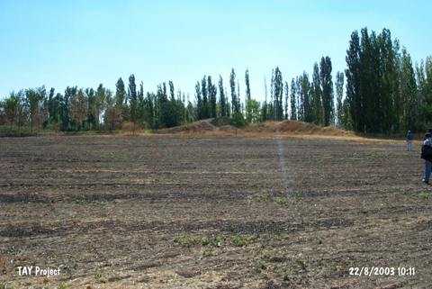 |
|
Type:
|
Mound |
|
Altitude:
|
740 m |
|
Region:
|
Black Sea |
|
Province:
|
Amasya |
|
District:
|
Merzifon |
|
Village:
|
Merkez |
|
Investigation Method:
|
Survey |
|
Period:
|
|
|
|
|
 |
|
| It is situated at the 3rd km of the Merzifon-Gümüshacıköy motorway, 1.5 km to the south of the motorway within the boundaries of the Samadolu Village. It measures 100x70x15 m in dimensions. Sherds dating to the EBA, MBA, LBA, Iron Age, Hellenistic and Roman Periods were collected. |
| Location: |
| Geography and Environment: |
| History: |
| Research and Excavation: |
| Stratigraphy: |
| Small Finds: |
| Remains: |
| Interpretation and Dating: |